Land North of Iver Station
Welcome
Thorney Lane LLP are bringing forward proposals for new homes and facilities on the land north of Iver Station, also known as Thorney Business Park.

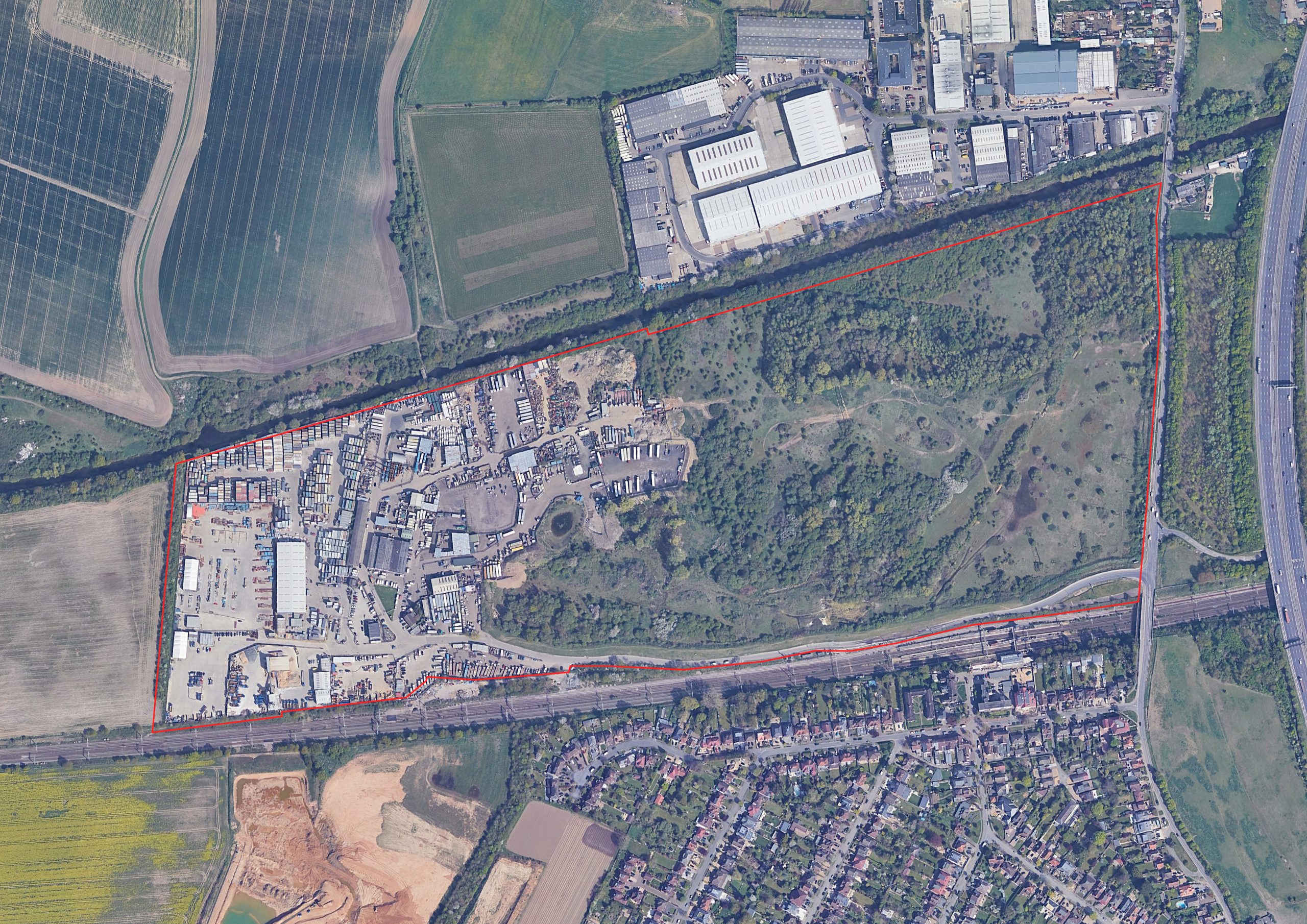
The land north of Iver Station, outlined in red
The total site is 43.5 hectares. Approximately 40% of the land at the western end is developed, occupied by various employment uses associated with the Business Park, while the remaining land is scrubland and former landfill within the Green Belt.
The redevelopment of the site has been under discussion for many years. Thorney Business Park generates a significant number of HGV movements, and redevelopment of the site creates the opportunity to close the Business Park and end those HGV movements.
The Ivers Neighbourhood Plan, prepared by the local community, has been a part of Buckinghamshire Council planning policy since March 2023. The Neighbourhood Plan acknowledges that redevelopment of the site – including the part within the Green Belt – is necessary to bring the site’s HGV-generating uses to an end.
With that in mind, the Neighbourhood Plan supports the creation of a data centre on the part of the site excluded from the Green Belt and allocates the remainder of the land for the creation of a ‘new northern half of Richings Park village’, including new homes and other facilities.
Privacy Policy
This website is owned and managed by SP Broadway on behalf of Thorney Lane LLP.
Our privacy policy explains what personal data or information we collect from you when you visit this website and / or provide your feedback, and how we use it.
Click here to view SP Broadway’s privacy policy in full, or click here to view a shortened version focusing on the personal data and information we collect during public consultations on development proposals.
Contact Us
If you have any queries, please contact Adam Robinson of SP Broadway on
07711 262925 or at adam@spbroadway.com
